Agriculture Aerial Surveys
Agricultural aerial surveys provide farmers and land managers with detailed, bird’s-eye views of their crops and fields, enabling smarter, faster, and more informed decisions.
At Vertex SkyPrint, we specialise in high-resolution drone surveys, aerial photography, and cinematic video capture tailored for agriculture, construction, and land management. Leveraging cutting-edge UAV technology, we provide accurate, data-rich visuals that empower smarter decision-making on the ground. Whether you're monitoring crop health, surveying development sites, or showcasing your project from a striking new angle, our aerial solutions deliver clarity, efficiency, and perspective — all from the sky.
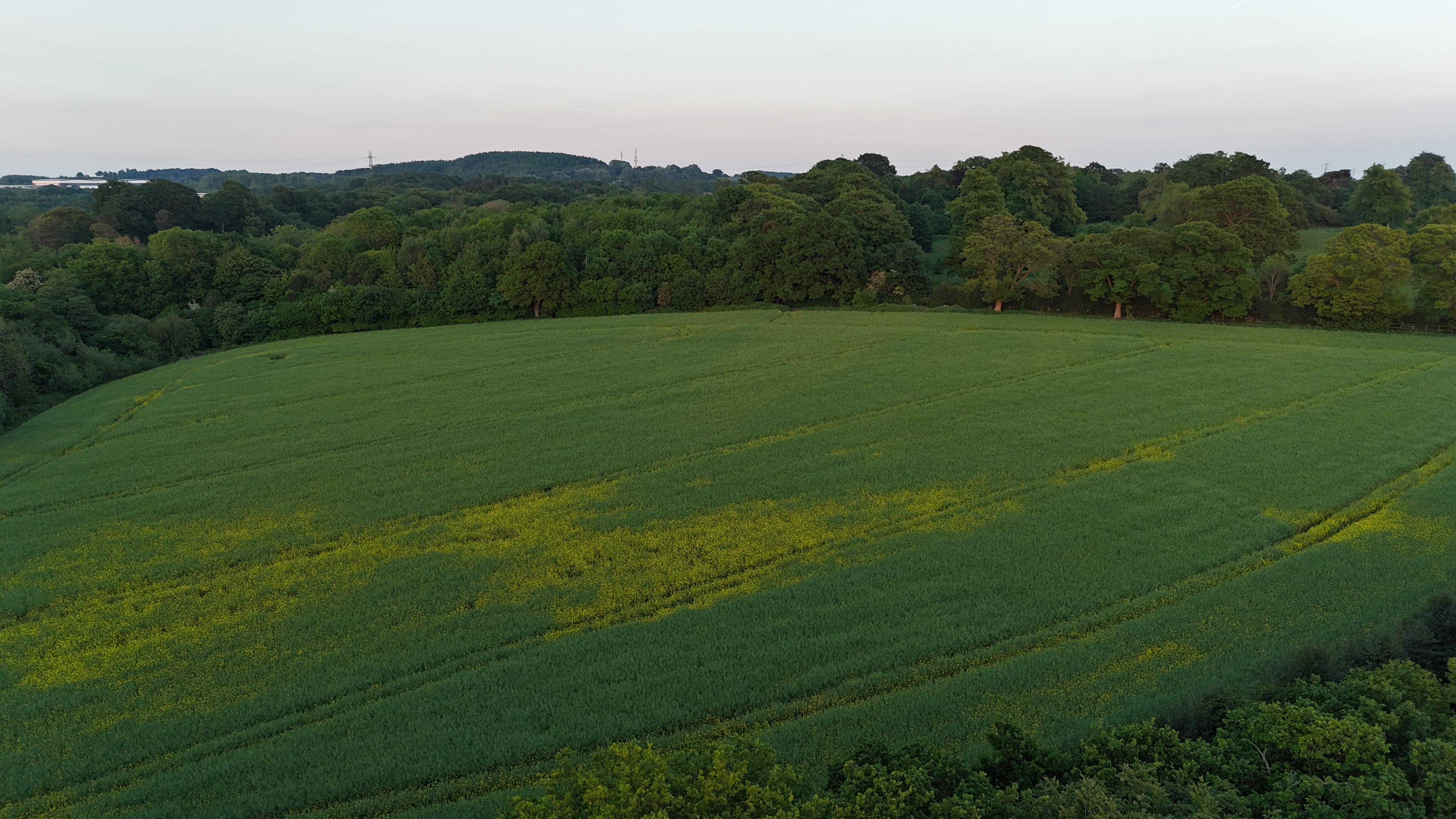
Agricultural aerial surveys provide farmers and land managers with detailed, bird’s-eye views of their crops and fields, enabling smarter, faster, and more informed decisions.
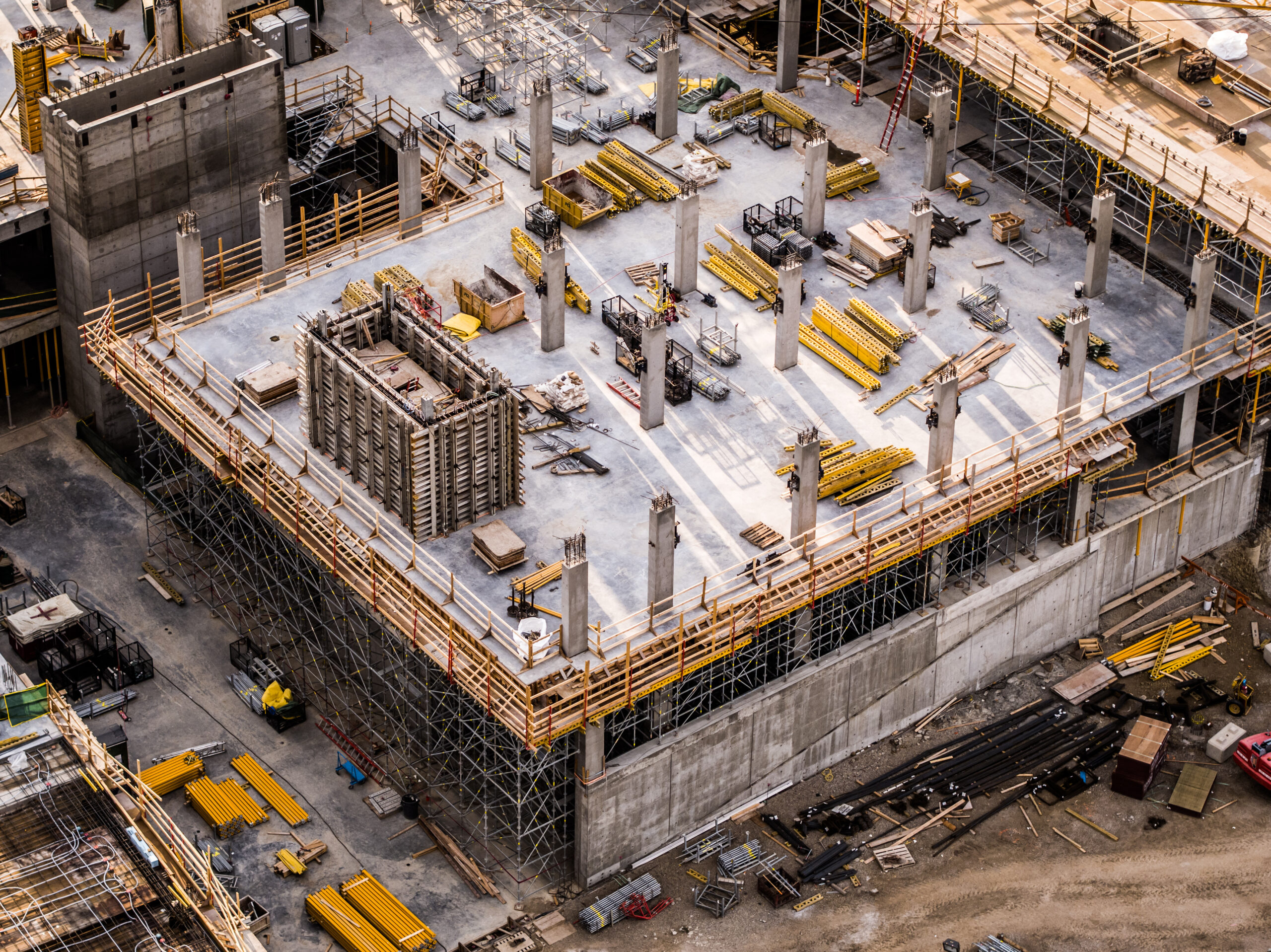
Drone construction monitoring and roof inspections combine aerial data collection with reporting and visual analysis to support site management, safety, and maintenance decisions.

Drones provide a fast, flexible, and intelligent way to enhance public safety and situational awareness during events, protests, emergencies, or in high-risk locations.
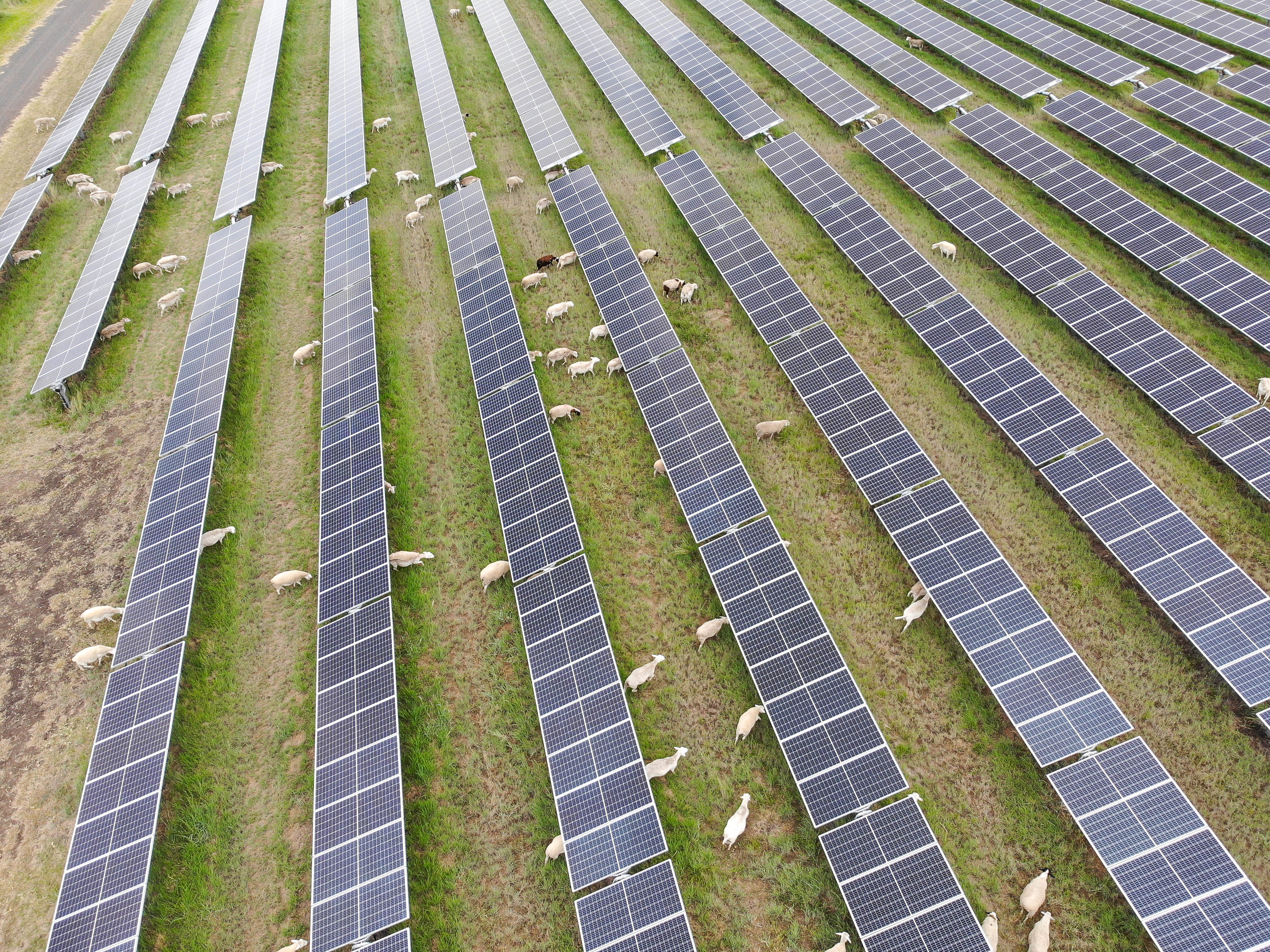
Drones offer a fast, safe, and cost-efficient solution for inspecting solar installations — from residential rooftops to vast solar farms. Using high-resolution and thermal imaging, drone inspections help ensure optimal performance, safety, and compliance.
Based in the heart of the West Midlands, Vertex SkyPrint is a newly established, two-person team turning a shared passion for aviation and drone technology into a purposeful business. Born from years of personal interest and hands-on experience with drones and aircraft, we’ve channelled that enthusiasm into delivering high-quality aerial surveys, photography, and videography services for the agriculture and construction sectors. While we may be a small operation, our commitment, technical know-how, and love for what we do drive us to provide precise, reliable, and cost-effective drone solutions — all while continuing to enjoy the hobby that brought us together.
Fully Insured - Public Liability EC Regulation 785/2004
A2 Certificate of Competency (A2 CofC)General Visual Line of Sight Certificate (GVC)
Permission for Commercial Operations (PfCO)
“From our initial enquiry through to communication, professionalism, and final delivery, Vertex SkyPrint exceeded expectations across the board. For such a small and newly established company, they demonstrated impressive technical expertise and a clear understanding of our specific requirements.”.
Jonathan, Lincoln
DJI 4 Pro
DJI Phantom
DJI Inspire 2
Custom Made Task Specific Drones
Sponsorship Coming Soon...
From a young age, I was captivated by aviation — earning my Private Pilot Licence in my early thirties and flying drones and model aircraft across iconic locations like the Mach Loop and Cheddar Gorge. That spark has reignited, and I’ve made the decision to channel my lifelong interest, skills, and experience into building Vertex SkyPrint.
At Vertex SkyPrint, our goal is to harness the power of drone technology to bring smarter, more efficient solutions to the agriculture and construction industries. We aim to provide cost-effective aerial surveys, photography, and video services that help farmers manage their land with greater precision and enable construction professionals to monitor, plan, and document their projects with clarity and confidence.
Info@VertexSkyPrint.co.uk
+44(0)7853000000
Message us on Whatsapp